Case Study 16 / 27Digital Twin / IoT & Telemetry Integration / Construction Technology
Custom Petrosea Digital Twin Integration (Veerum Platform)
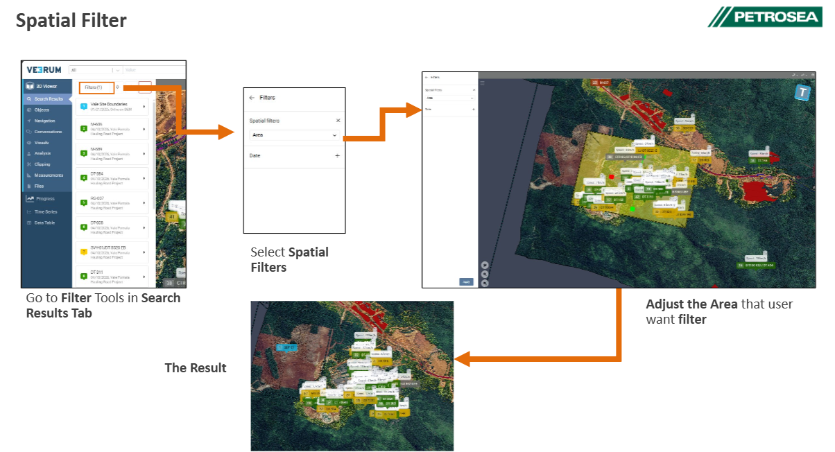
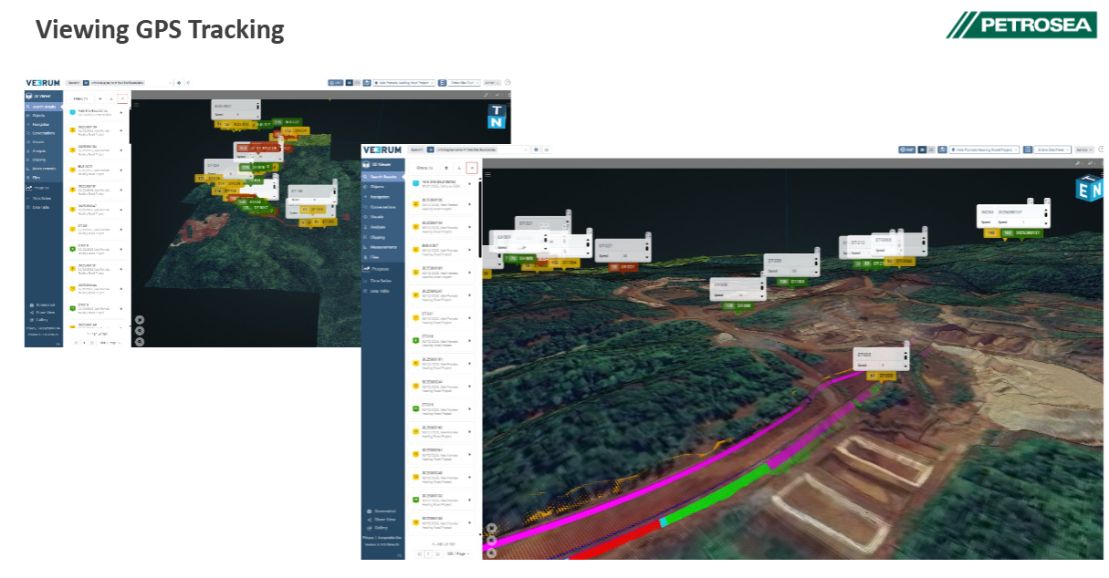
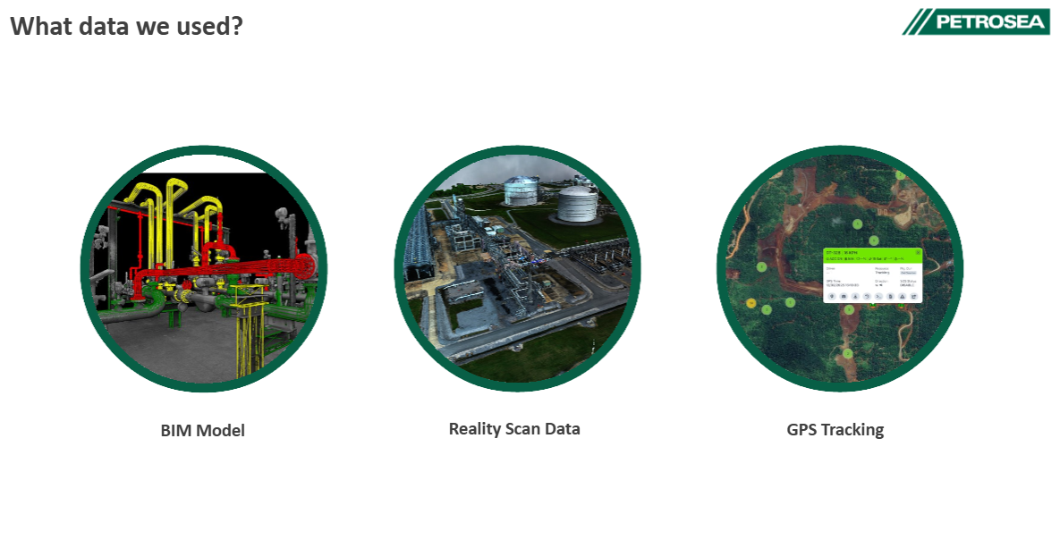
Spearheaded a custom Digital Twin with vendor Veerum, integrating CAD models, LiDAR/satellite scans, and live GPS telemetry.
Problem
Site monitoring suffered from a disconnect between design files, survey scans, and real-time fleet tracking.
Solution
Spearheaded a custom Digital Twin with vendor Veerum, integrating CAD models, LiDAR/satellite scans, and live GPS telemetry.
Impact
An immersive 3D platform unifying real-time fleet positioning with as-built engineering data.